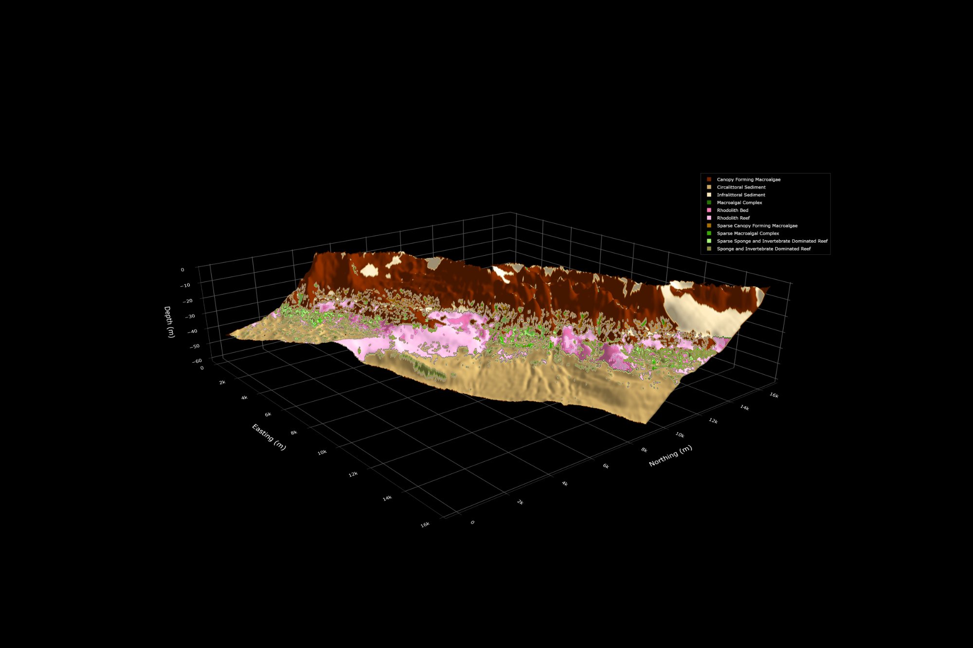
Merrow Mapping delivers rigorous marine ecosystem modelling — from benthic habitat mapping to species suitability and community distribution models — for researchers, agencies, and coastal managers.
Capabilities
From seafloor characterisation to predictive modelling, we translate complex ecological data into clear, decision-ready spatial products.
Benthic and intertidal habitat characterisation integrating acoustic, optical, and environmental data. From broad-scale classifications to fine-resolution maps.
01Predictive spatial models of habitat suitability for key marine species — corals, seagrasses, invertebrates — using MaxEnt, BRT, and ensemble methods.
02Multi-species assemblage and community composition mapping to delineate ecological zones, biodiversity hotspots, and functional habitats across seascapes.
03Spatially explicit ecosystem models linking physical oceanographic drivers to biological responses — supporting impact assessment and management planning.
04Advanced geospatial analysis, remote sensing integration, and production-ready GIS deliverables tailored for marine protected area planning and EIAs.
05Scientifically rigorous technical reports, interactive maps, and stakeholder briefings that make complex modelling outputs accessible to decision-makers.
06About
Merrow Mapping is an independent marine consultancy bringing together ecological expertise and advanced spatial modelling to answer the questions that matter most for ocean stewardship. We work with government agencies, research institutions, environmental managers, and the private sector across Australian and Indo-Pacific waters.
Every model grounded in current ecological literature and best-practice validation.
From survey design and data wrangling to final maps and written reporting.
Full uncertainty reporting, reproducible code, and open data where possible.
Products designed for real management decisions, not just academic outputs.
How we work
Rigorous, repeatable, and tailored to the ecological and management context of each project.
We begin with a thorough scoping of objectives — what decisions will the outputs support? What spatial extent, resolution, and ecological detail is required?
Existing survey data, remote sensing imagery, bathymetry, oceanographic layers, and biological occurrence records are assembled, quality-controlled, and harmonised.
Appropriate statistical or mechanistic models are selected, trained, and rigorously validated against independent data using spatial cross-validation and performance metrics.
Maps are generated across the full study area with explicit quantification of prediction uncertainty — critical for confident management decisions.
Final deliverables — maps, GIS files, and reports — are packaged with clear interpretation guidance and presented to stakeholders in accessible formats.
Get in touch
Whether you have a defined scope or an early-stage question, we'd welcome a conversation about how Merrow Mapping can help.
[email protected]